Here is more info:
Belize - a country rich in a variety of coastal ecosystems!
The coastal land is where humans, thousands of creatures, clear waters and time converge to create a unique multifaceted region and a rich country.
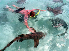
With over 1000 cayes and 220 kilometers of Barrier Reef ( one of the seven underwater wonders of the world) Belize is a country that possesses natural wealth through a variety of coastal ecosystems ranging from coral reefs to seagrass beds, from extensive mangrove and littoral forests to coastal lagoons and estuaries. It is these habitats which serve as essential breeding, rearing and feeding grounds for a vast array of living things.
Seagrass beds, mangrove and littoral forests are vital for flood and erosion control. They are also important in maintaining coastal water quality by catching terrestrial run-off resulting from agricultural activities such as land clearance and the use of agro-chemicals. Coral reefs act as a protective barrier. Likewise, all the other coastal ecosystems serve to protect coastal areas from storm damage and provide a livelihood for many Belizeans through industries such as fisheries and tourism.
The many functions and roles of the coastal habitats and inhabitants are evident in the bustle of activities and uses of the region from north to south and from east to west. It is with great concern that we note the increasing pressure to develop economically and to provide for recreational facilities within the coastal zone. A more efficient harvesting of marine products has further intensified the need for reliable information on the status and sustainability of these resources.
Satellite image of coastal zone
Knowledge of the functions of these ecosystems is important but so, too, is having positive attitudes — attitudes that will translate into the actions that lead to the best use of these resources. The functions of these ecosystems are all too vital and precious for us to ignore. In fact, the coastal ecosystems are a legacy for Belizeans to prize, and also a legacy that can be merged into our daily lives with care and wise use.
This is a complex system that includes the shoreline, in addition to the coastal plains, the lagoons and estuaries, the cayes and atolls, plus the subtidal area within the 19 kilometer territorial limit and a 322 kilometer exclusive economic zone. This includes the continental shelf which is approximately 257 kilometers long and 15-40 kilometers wide.
Given the distinct features of each region, one can see why the shelf can be separated into four regions : coastline, inner lagoon, barrier platform and coral atolls. The coastline consists of lagoons, sandridge barriers, river deltas and estuaries while the inner lagoon is the area immediately bordering the mainland, with Belize City demarcating the northern and southern regions. The third region is the barrier platform which is seaward of the inner lagoon and the last region consists of the three coral atolls which are seaward of the continental shelf. The inner lagoon region that lies between the platform flat and mainland forms a gently sloping underwater valley that is wide and shallow north of Belize City and which falls as much as 64 meters deep, east of Punta Gorda. On the other hand, the continental shelf north of Belize City, rarely reaches a depth of greater than 10 meters.


No comments:
Post a Comment